
It’s all about the map! Flood hazards and standard land values available in the new map manager
To kick off the new year, we already have a number of new services to announce on IZ Research. In the January release, it’s all about the map. With the live launch of the flood hazard map and the standard land value map, we are further expanding the map scope on IZ Research. We are also introducing the new map manager as an intuitive tool for searching and displaying theme and background maps.Standard Land Value Map
The new standard land value map provides easily accessible standard land values for all federal states and city states in Germany in which the real estate valuation committees have joined the OpenData Initiative of the Federal Government (https://www.govdata.de/dl-de/by-2-0). First, we are starting with all municipalities in North Rhine-Westphalia and Thuringia. Lower Saxony has been live since 1st March 2023, Hesse since 24th Mai 2023. The standard land value maps for Brandenburg, Bremen, Berlin, Hamburg, Hesse and Lower Saxony will be added in the next few weeks. You can then view the standard land values determined by the regional valuation committees (in accordance with §193 para. 5 BauGB) centrally on one map.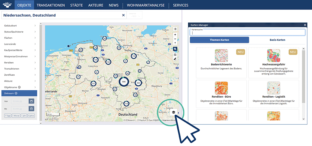
View the standard land value map as a theme map in the map manager.
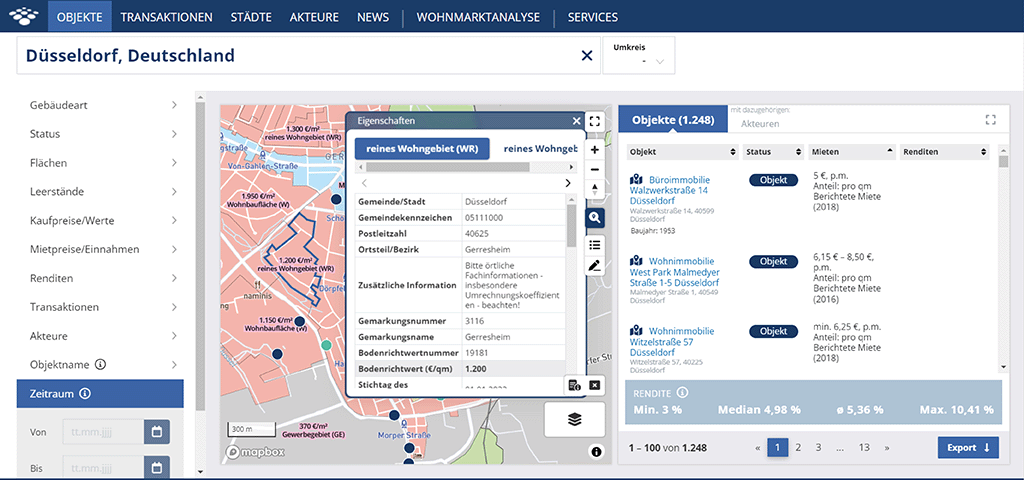
Within the scope of your address or area search, the standard land value in €/sqm of property area is displayed on the map, which is valid as an average site value for the properties with identical use and value ratios included in the standard land value zone.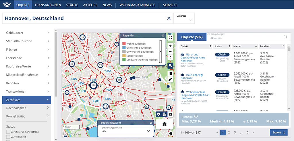
For the selected standard land value zone, double-click to open an additional window that shows you the essential property features or building regulations such as the type and extent of building use according to BauNVO.
Flood hazard map shows the extent of flooded areas for the whole of Germany
River floods or floods originating from the sea are natural events. River floods occur regularly and with fluctuating intensity and are typical of the discharge behaviour of rivers. The intensity of floods depends on the intensity and duration of precipitation, the characteristics of the catchment area and the special features of the river. With increasing building development near rivers and the straightening of river landscapes, the floodplain landscapes have disappeared in many places and the rivers have been deprived of their natural floodplains. Due to climate change, flooding frequency in Germany is already increasing and will continue to do so in the future. In particular, heavy rain is causing rivers and streams to repeatedly burst their banks, and extreme weather in coastal regions is also becoming more frequent. Accordingly, it is important that cities and municipalities, property owners and project developers are aware of these hazards and take appropriate precautions against environmental risks. With the implementation of the flood hazard map in IZ Research, we would like to provide our clients with an important source of information for risk assessment. The flood hazard map shows the extent of the inundation areas during floods depending on the frequency of a flood event. The extent of flooding and the frequency of flooding in the affected areas are used to calculate the probability of flooding. The data on flood-prone areas are based on nationally homogenised data sets provided by the Federal Institute of Hydrology and defined by Directive 2007/60/EC of the European Parliament and of the Council of 23 October 2007 on the assessment and management of flood risks.
The flood hazard map on IZ Research depicts the inundation areas in three different flood scenarios, which you can select in a drop-down menu.
- High scenario = floods with a high probability or frequent, regular floods as well as extreme events that occur on average every 10 to 20 years.
- Medium scenario = Floods with a medium probability, with an expected recurrence interval of ≥ 100 years.
- Low scenario = Low flood frequency, i.e., less frequent than every 200 years, or with a low probability of extreme events.
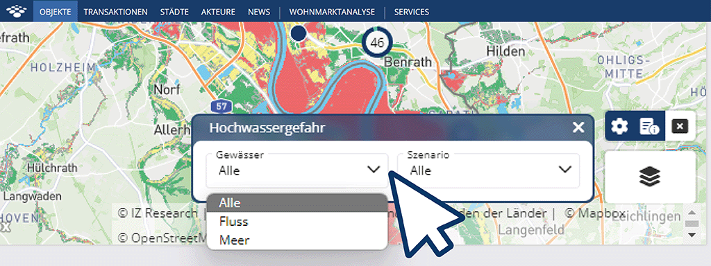
The information from the flood hazard map helps you to assess whether the property or location to be evaluated is at risk from flooding and whether you may need to take protective measures, such as flood-adapted construction or special financial protection through the appropriate insurance.
Map Manager
The release of the two new theme maps is just the beginning. We plan to go live with more theme maps in the future. All these maps are available in the new map manager. This offers an intuitive tool for searching and displaying theme and background maps in a clear and concise structure. The map manager can be opened by selecting the corresponding symbol on the source map of IZ Research.
The map manager overview contains the entire IZ Research range of theme maps in the “Theme maps” tab: the yield map, the standard land value map, the flood hazard map or the iib residential location map. In addition, we offer various basic maps in the “Basic Map” tab, from which you can individually select your map background. Above the tabs, you can search for theme maps using keywords in the search box.