Release 2022-11 – New IZ Research Functions
The new functions in the IZ Research maps now enable a worldwide search for transactions and properties/projects. In addition, newly drawn polygons as well as those which are already saved, can now be edited. Another new feature in the “Properties” application displays building ensembles and their associated properties.Worldwide search for transactions and properties now available!
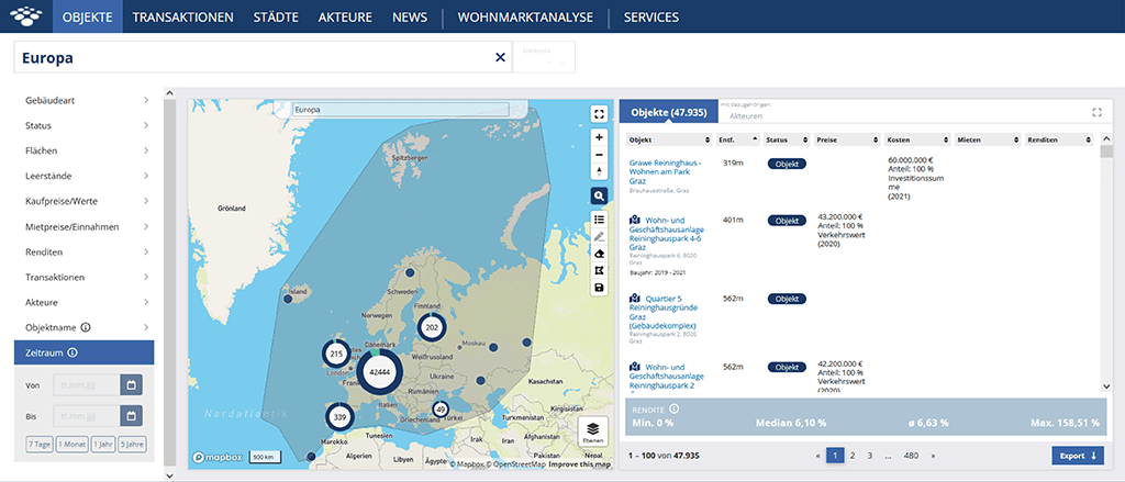
From now on, you can extend your spatial search outside Germany in the “Transactions” and “Properties” applications on IZ Research. This means, for example, that you can display known and recorded properties throughout Europe or the transaction activity recorded in IZ Research in North America. The individual continents are each displayed as polygons by default and can be selected via the search field in “Transactions” and “Properties”. We have added a third section to the search field for this purpose, which suggests individual continents to the user.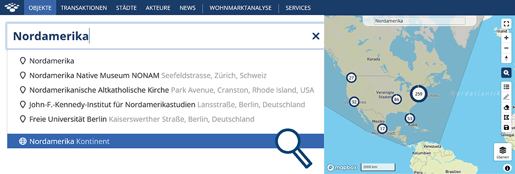
You can save, delete and edit this polygon. The saved polygon is displayed in the overview of the polygons you have already saved.
With new zoom levels, you can also quickly zoom out of the map, so that the polygon of the entire continent or the entire world map is visible.
Polygons can be edited
By adding the function to edit drawn and already saved market areas (polygons), we have created another possibility for users to optimise a search query with the help of the map. This allows you to correct any drawing errors immediately without having to adjust a polygon you have already saved or draw it again. You can activate or deactivate the editing function via the new edit button. By clicking on the polygon, you can then move points by dragging or adding a new point and thus enlarging the polygon. Changes can be saved afterwards using the save button. The displayed polygon will also continue to be displayed when changing the map layers and the map base (map to satellite image) if you leave it open.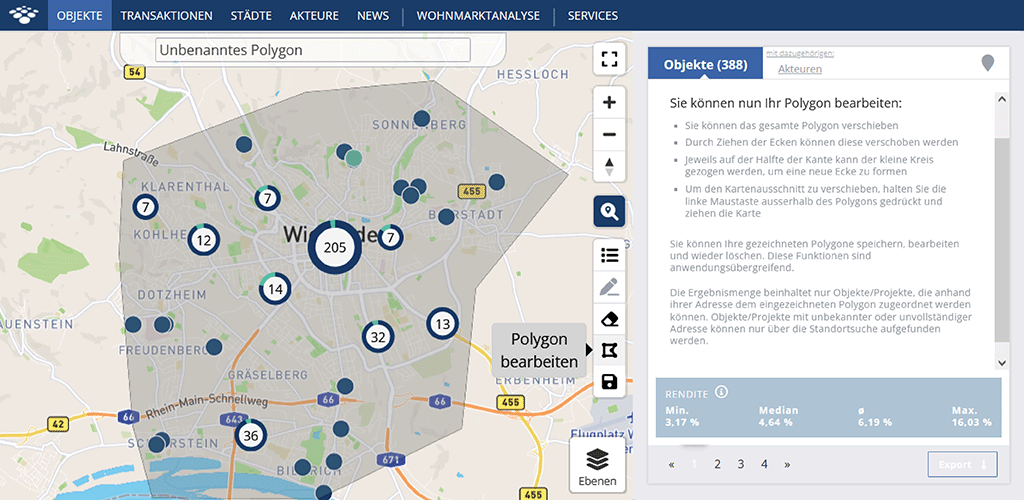
Information on building ensembles and their associated properties
Another new feature we have added enables building ensembles and their associated properties to be displayed in the “Properties” application. In the “Overview” area you can now find a new field called “Ensemble”. All properties belonging to the ensemble are listed here, which in turn are linked to the respective property details page.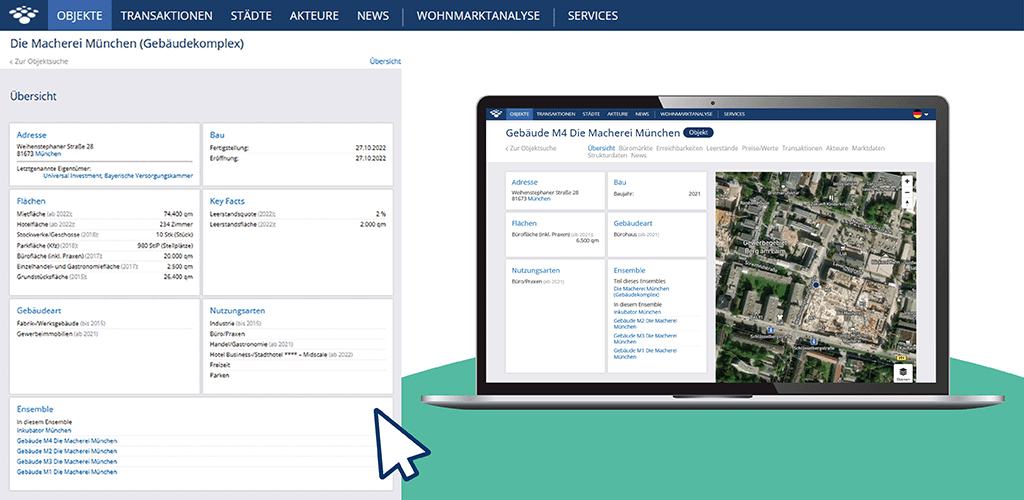
On the detail page of a property that is part of a building ensemble, you will then receive further information. In the section “Part of this ensemble” you will also find the link to the main ensemble.
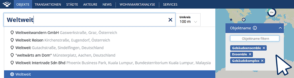
Expert tip: How to find all building ensembles
Enter “Worldwide” in the search field above and then “Building Ensemble”, “Building Complex” and “Ensemble” in the “Property Name” field. To do this, simply type in each term and press Enter to confirm.